


Description
Prevent drought stress in trees
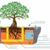
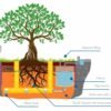
In addition to the water tension sensors, soil moisture sensors can be connected to measure soil moisture, conductivity, and temperature. Combining data from both sensors generates watering recommendations that enable resource-efficient irrigation. This helps minimize the risk of over or under-watering. Additional parameters required include the size of the tree disc, soil’s available water holding capacity, and the depth of root penetration.
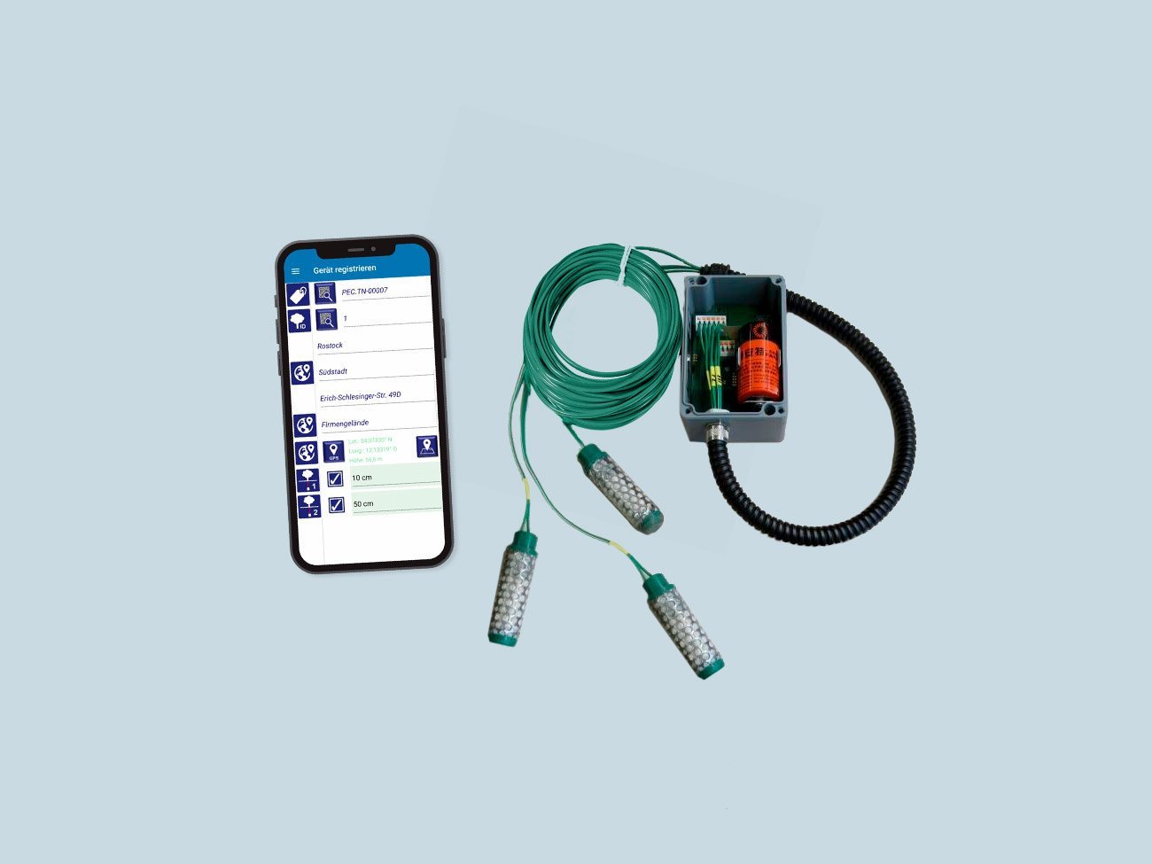
Installation & Handling
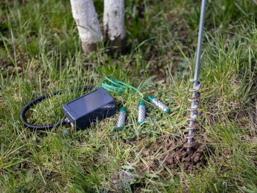
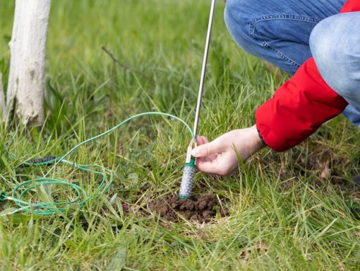
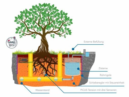
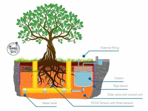
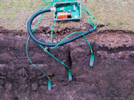
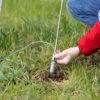
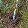
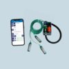
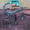
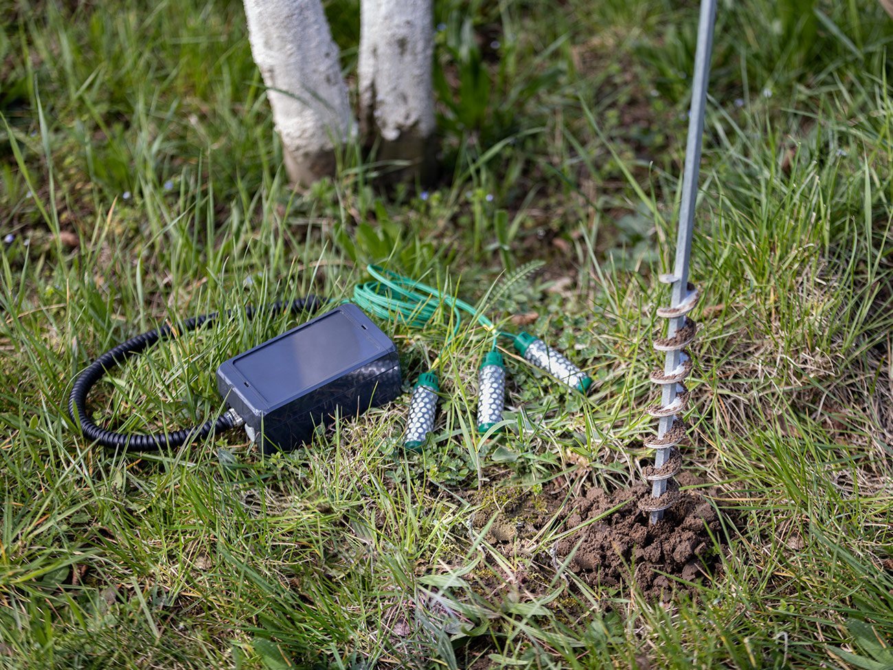
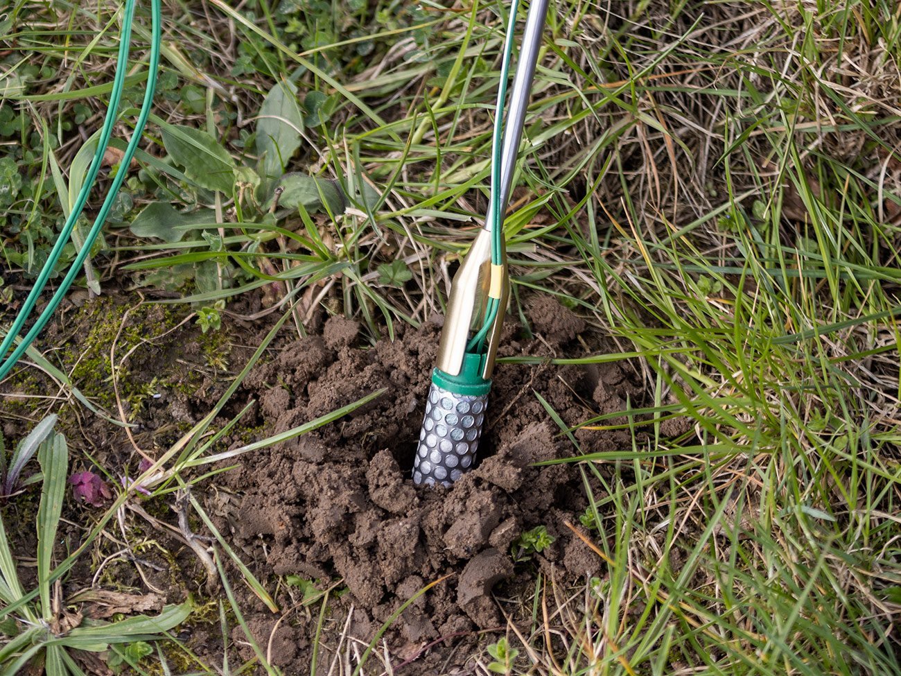
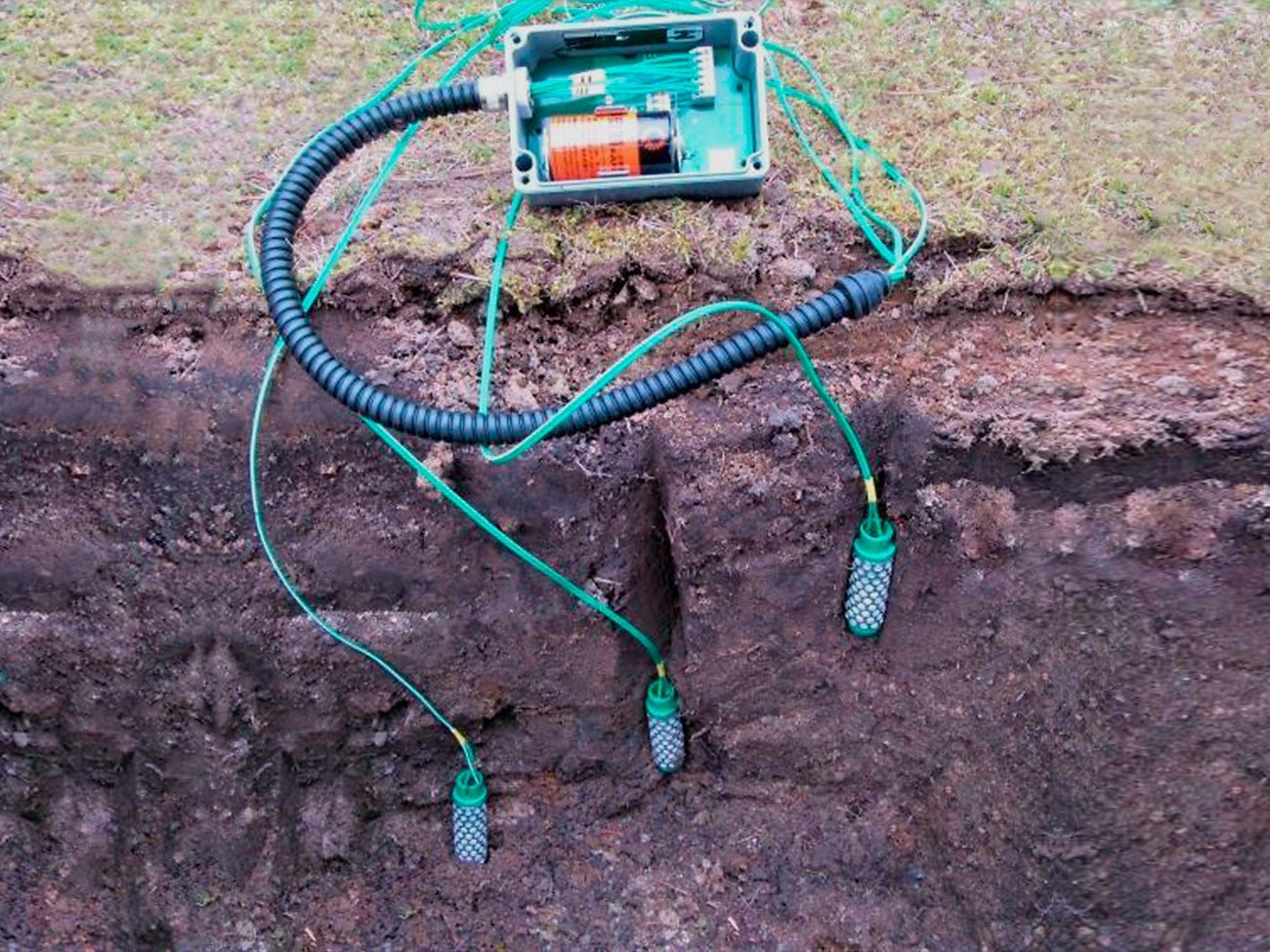
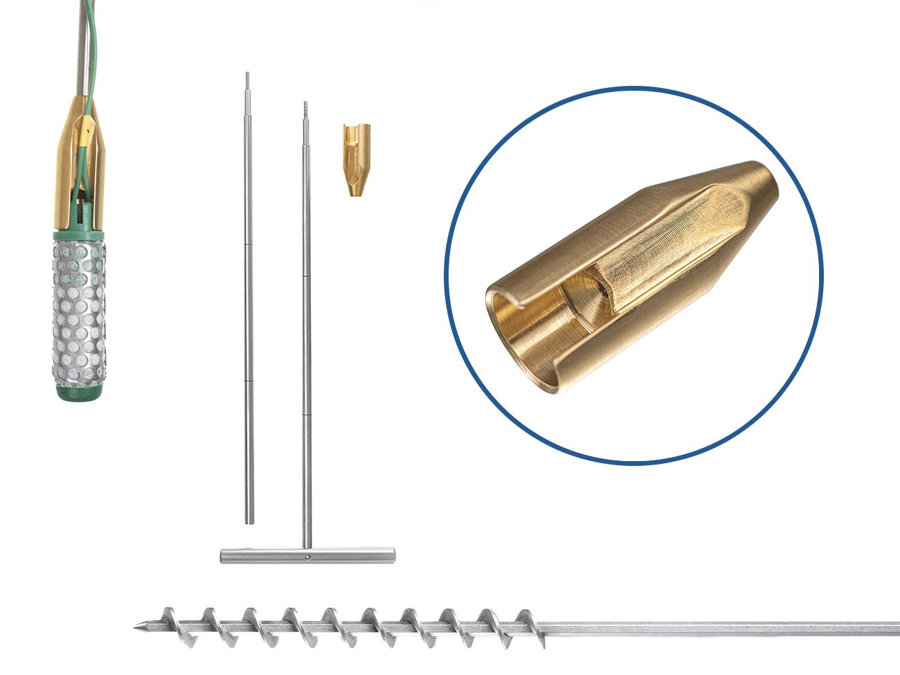
The PiCUS Tension sensors can be installed directly during the planting of young trees on-site or retrospectively on mature trees that are particularly vulnerable or worthy of preservation. If desired, the sensor elements can be inserted at various depths or positions around the tree. The central electronics can be mounted above ground, for example, on the planting support of a young tree, or buried. Using an earth auger and the IML installation aid, the soil water tension sensors can be positioned accurately.
Measurement variables
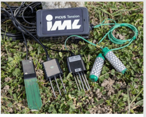
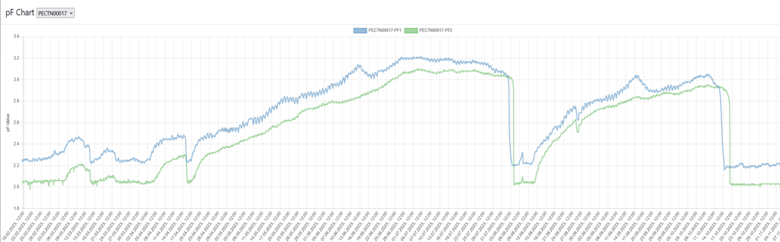
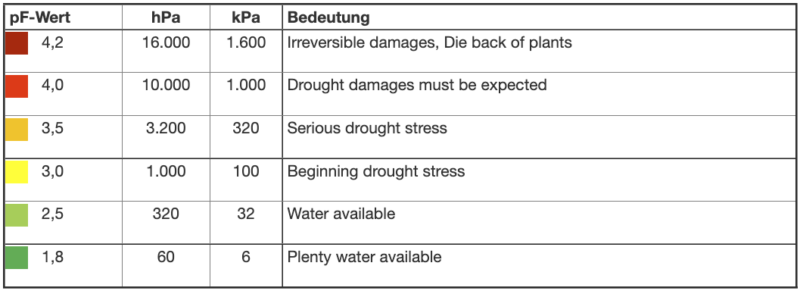
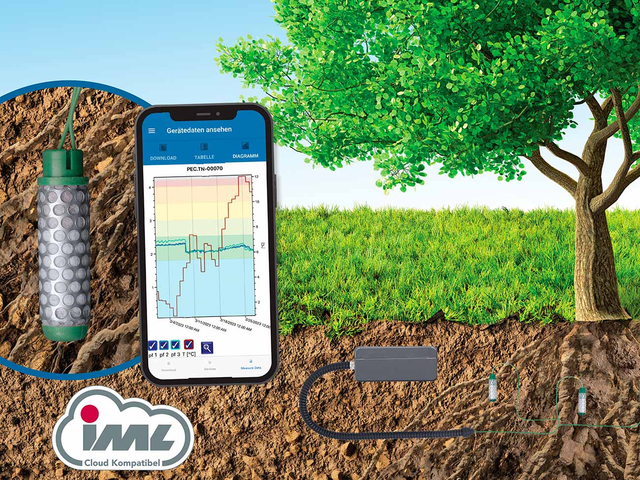
Soil water tension refers to the force with which water is held in the pores of the soil, indicating the amount of force plants need to exert to access water. The lower the soil water tension, the more easily water is available to plants. Conversely, high soil water tension makes water less available to plants. In addition to soil water tension, the current temperature is also measured within the transmitting unit and depicted in the graph.
The optionally mountable soil moisture sensor with a cable length of 10 meters measures soil moisture, soil conductivity, and soil temperature. Using the corresponding soil parameters, the unutilised water absorption capacity of the soil or granulate can be determined. This enables needs-based irrigation.
Hardware
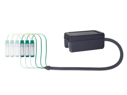
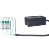
There are LTE and LoRaWAN variants of the Tension system available.
PiCUS Tension LTE MIX 7 Inputs
- Includes cloud and data connection
- Very easy setup with pre-configured and pre-assembled units
- Included SIM card with 500 MB is usable worldwide (no subscription, included in the price, data volume sufficient for more than 100 years)
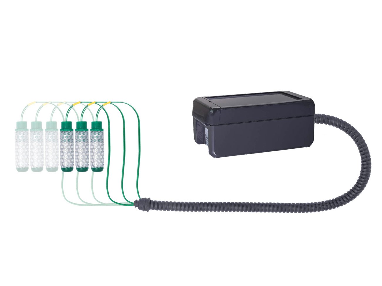
- Supports up to 7 soil water tension sensors (pf) or soil moisture sensors (rH in % and Temperature in °C), combinations or other sensor types on request
- configurable length of sensor cables
- Android and iOS app support
PiCUS Tension LoRaWAN MIX 7 Inputs
- Very easy setup with pre-configured and pre-assembled units
- Supports up to 7 soil water tension sensors (pf) or soil moisture sensors (rH in % and Temperature in °C), combinations or other sensor types on request
- Frequency Europe 863.870Mhz
- configurable length of sensor cables
*Please note that for a custom LoRaWAN network, currently no evaluation and interface software is offered; please inquire separately. There is the option to evaluate and filter data through the free “thethingsnetwork” and IML GIS. See LoRaWAN options.
Accessories
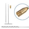
- Installation aid 120 cm
Installation aid to place the sensors in the soil - Cable protection 50cm
Metal protective hose as cable protection for above-ground installation, e.g., during mowing - Pointed probing rod 30cm
Can be used as a probing rod in combination with the installation aid - Earth auger 30 mm x 1000 mm
- Installation shaft with screw cap
IML GIS
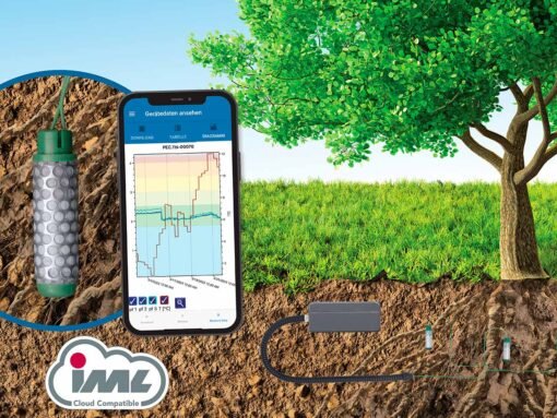
In the IML GIS, there’s the capability to filter data, export it in various formats for further external processing, and integrate it into external software solutions. Automatic forwarding from the IML Cloud to a client-owned database is optionally possible, enabling data integration into existing infrastructures such as a cadastre database.
IML GIS Reporting
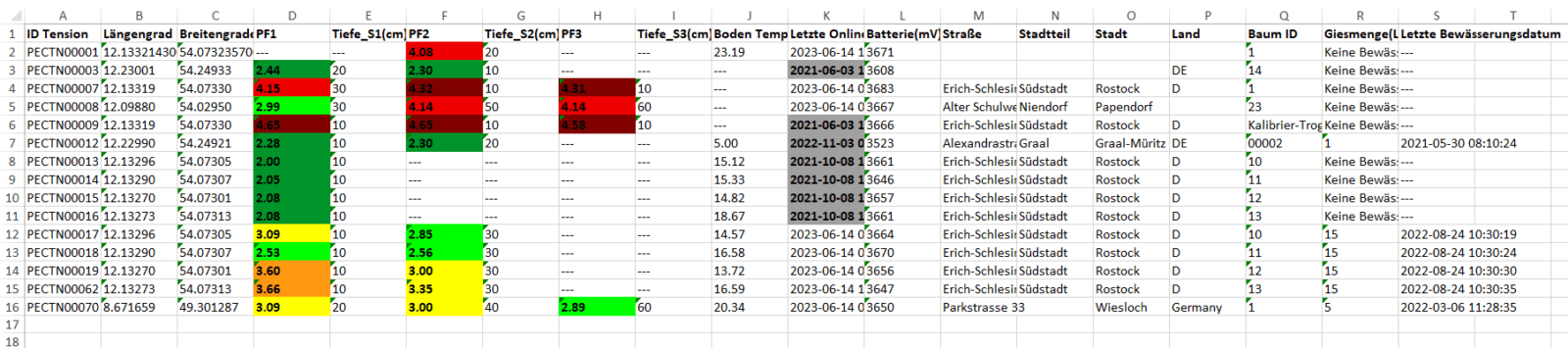
The measurement data can be filtered, for instance, by pF value, and this can generate a clear Excel file. This presents a clear view of which trees require watering.
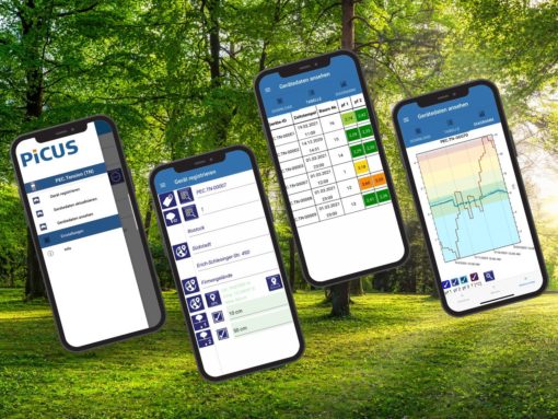
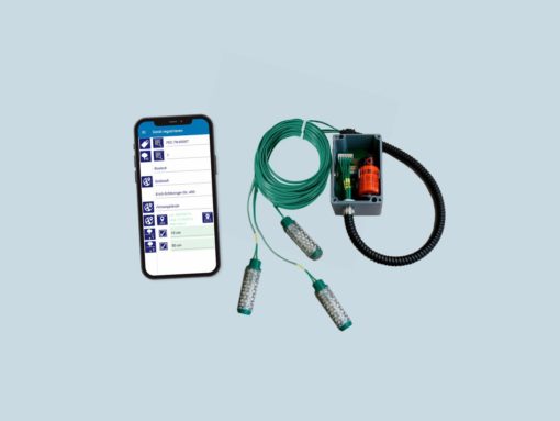
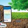
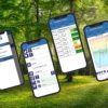
IML Cloud Devices App
The IML Cloud Devices App is necessary for setting up the system and documenting water inputs, such as:
- Tree parameters
- Soil parameters
- Number of sensors and sensor depth
- System location (displayed in IML GIS)
- Data query for current status, etc.
IML Cloud
With the LTE variant, sensor measurements are taken every hour, and the stored data is sent to the IML Cloud every 12 hours. This transmission interval allows for up to three years of operation without needing to replace batteries. The data stored on the server in Rostock is processed and visualized in the IML GIS or the IML Cloud Devices App.
LoRaWAN Options
In a client-owned LoRaWAN network, such as in “smartcity,” the system is configured for data transfer to the client’s own data infrastructure. In this case, however, the client needs to process and visualize the data. Alternatively, if the client provides raw data to the IML Cloud, it can be processed and visualized in the IML GIS. This variant is customer-specific and needs to be requested accordingly.
Forwarding data from a public LoRaWAN network, like “thethingsnetwork” (TTN), to the IML Cloud is possible to view the data in the IML GIS. This offers the advantage that the client can utilize the LoRaWAN variant without needing to develop, purchase, or set up their own visualization and evaluation software. However, the availability of a TTN network is required.
Shared Comparative Database (optional)
During setup, IML Cloud provides the function of making data available on a comparison platform for measurement values. Property owners can access data on comparable trees or sites through the database, providing references for their own evaluations and planning. Only data about the tree and installation situation are visible, never about the user or location. Participation in the comparative database is voluntary.
Sustainability
The system is designed for continuous use for up to 3 years. The transmitter unit can be reused by replacing the battery. Since the Watermark soil water tension sensors remain in the soil, they need replacement and expert reconnection to the transmitter unit.